
BTMETER BT-100WM
4.1Editor score
Multi-function data log
Backlit LCD screen
High precision readings
Finding the right handheld altimeter is crucial for outdoor enthusiasts who need reliable elevation data during hikes. A good device offers accurate readings, durable construction, and easy-to-read displays to ensure safety and navigation precision in remote areas.
We evaluated ten leading models based on their performance, user feedback, and feature sets. Our comparison includes analog and digital options, focusing on battery life, weather resistance, and additional functions like barometers and compasses to meet diverse outdoor needs.
Each pick highlights specific strengths such as ruggedness or multifunctionality to suit different activities. Prices and availability can change frequently, so verify current details before purchasing. This guide aims to simplify your decision with clear, concise information on top-rated altimeters.
4.1Editor score
4.3Editor score

4.6Editor score
As an Amazon Associate we earn from qualifying purchases.
This side-by-side comparison details the key specifications and features of all ten models to help you find the perfect fit for your outdoor adventures.


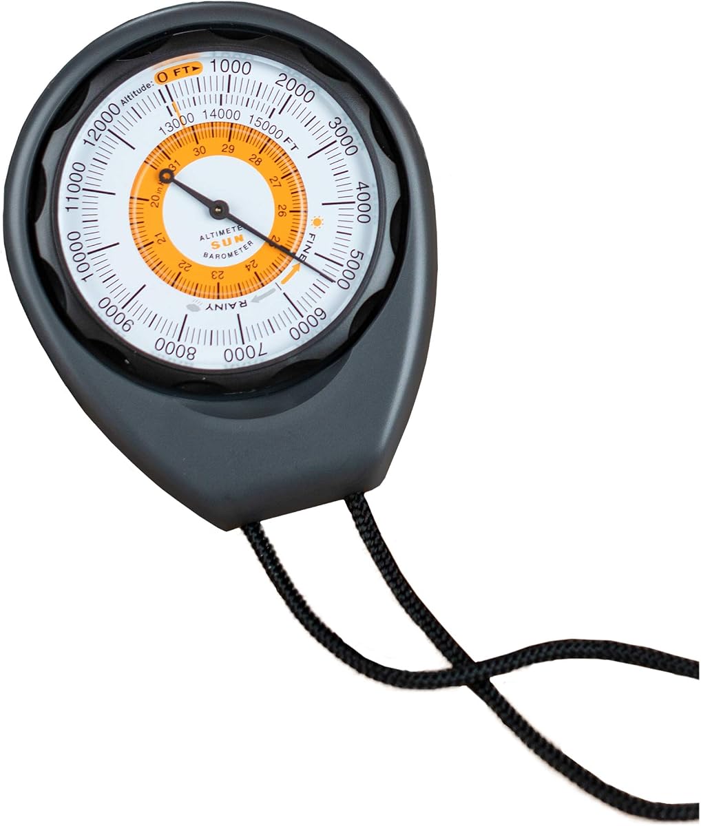
The Sun Company Altimeter 203 stands out as a reliable choice for hikers who prefer analog tools. With a rating of 4.3, it offers battery-free operation that ensures long-term use without frequent replacements.
We may earn a commission when you buy through this link, at no additional cost to you.
Its rugged ABS case protects the internal mechanism from drops and moisture, making it suitable for varied terrains. The adjustable dial allows users to account for local pressure systems, enhancing accuracy during hikes or camping trips.
While the range tops out at 15,000 feet, which may limit extreme mountaineering, it suffices for most recreational activities. The manual calibration process is straightforward but requires a reference point for best results.
Ideal for those seeking a compact, low-maintenance tool, this altimeter pairs well with compasses and thermometers. It is an excellent entry-level option for outdoor enthusiasts who value simplicity and durability over advanced digital features.
The battery-free design means you never have to worry about power failures in remote areas. Its mechanical nature provides consistent readings without electronic drift.
Constructed with a tough ABS case and lanyard, it is built to withstand rough handling. Its compact size fits easily in a pocket or gear pack.
We may earn a commission when you buy through this link, at no additional cost to you.
The BTMETER BT-100WM offers exceptional value for users needing more than just elevation data. With a 4.1 rating, it combines altimeter functions with anemometer and barometer tools for comprehensive weather monitoring.
We may earn a commission when you buy through this link, at no additional cost to you.
Its digital interface supports various units like mph and knots, making it versatile for sailing or aviation enthusiasts. The data log feature allows tracking pressure trends over time, which aids in weather forecasting.
However, reliance on batteries means carrying spares for extended trips. The menu system can be intricate for beginners, but the backlit screen ensures readability in low light.
Best for budget-conscious adventurers needing multi-sensor capabilities, this device balances cost and functionality. It suits users who want detailed environmental data without investing in high-end GPS units.
Beyond altitude, this meter measures wind speed, temperature, and humidity. It is ideal for activities like kite flying, drone piloting, or long-range shooting.
Recording 16 groups of barometric data helps analyze pressure changes. This feature is useful for predicting weather shifts during outdoor events.
We may earn a commission when you buy through this link, at no additional cost to you.
The Garmin GPSMAP 65s represents the pinnacle of handheld navigation tools. With a 4.6 rating, it offers multi-band satellite support for precision in dense forests or urban canyons where other devices struggle.
We may earn a commission when you buy through this link, at no additional cost to you.
Its barometric altimeter ensures precise elevation tracking, complementing GPS data for reliable route guidance. The large color display is easy to read in direct sunlight, enhancing usability during long hikes.
The cost is higher than analog options, but the investment pays off in reliability and features. Users can track stats and manage routes via the Garmin Explore app, adding convenience for tech-savvy adventurers.
Best for serious hikers needing top-tier navigation, this device combines a rugged build with advanced mapping. It is a premium choice for those prioritizing safety and accuracy in challenging environments.
Multi-band technology ensures better signal acquisition in difficult terrain. This reduces the risk of losing track in remote areas.
Preloaded TopoActive maps simplify navigation without needing extra downloads. You can create routes and waypoints directly on the device.
We may earn a commission when you buy through this link, at no additional cost to you.
This 8 in 1 tool consolidates multiple instruments into a single handheld unit. Rated 3.4, it offers altitude, temperature, and compass functions, appealing to casual users seeking an all-in-one solution.
We may earn a commission when you buy through this link, at no additional cost to you.
The altitude range covers extreme values from -2300 to 29500 feet, making it suitable for high-altitude adventures. The 8-direction compass helps basic orientation during travel or mountain climbing.
Accuracy may vary compared to dedicated instruments, so it is best for general use rather than professional surveys. The low resolution of 3.3 feet can be a limitation for precise trail navigation.
A practical option for budget travelers needing basic metrics, this device is lightweight and easy to carry. It serves as a backup tool but should not replace primary navigation systems for safety-critical tasks.
Combining thermometer and weather info reduces gear weight. It is useful for quick checks without carrying multiple devices.
The carrying rope adds convenience for secure handling. The manual provides steps to set up the various measurement modes.
We may earn a commission when you buy through this link, at no additional cost to you.
This digital altimeter offers a similar 8 in 1 function set for hikers needing basic data. Rated 3.9, it includes a digital compass and barometer, helping users monitor environmental changes effectively.
We may earn a commission when you buy through this link, at no additional cost to you.
The elevation range reaches 29,500 feet, which accommodates most mountaineering needs. The digital display provides clear readings, though the backlight duration is short at five seconds.
Users should note that the barometer measures pressure between 300 and 1100 mbar, sufficient for most climates. It is a lightweight option that balances cost with utility for casual outdoor enthusiasts.
Best for those needing a quick reference tool for altitude and pressure, this device fits well in a pocket. It is a budget-friendly way to track weather trends without investing in premium equipment.
The design prioritizes portability for everyday use. It can be strapped to a gear bag for easy access during trips.
Tracking pressure helps predict incoming weather systems. It is useful for planning camping schedules based on forecasts.
We may earn a commission when you buy through this link, at no additional cost to you.
The Sun Company AltiLINQ is unique for its dual-use design, fitting both vehicle dashboards and outdoor trips. With a 4.2 rating, it provides analog accuracy without needing batteries for continuous operation.
We may earn a commission when you buy through this link, at no additional cost to you.
Its adjustable dial lets users correct for local pressure systems, ensuring precise altitude readings. The weather trend indicator predicts high or low pressure shifts, aiding in trip planning.
While the 15,000-foot limit suits most road trips and hikes, it may not cover extreme elevations. The two attachments allow easy transfer between vehicles or gear packs for flexibility.
Ideal for drivers who hike frequently, this device offers a seamless transition between road and trail. It is a smart choice for those wanting a reliable analog tool that fits multiple scenarios.
The detachable mount makes it easy to take the device anywhere. It is great for road trips where elevation changes are significant.
Instructions guide users on setting the dial for accuracy. The analog interface reduces complexity and power needs.
We may earn a commission when you buy through this link, at no additional cost to you.
This clinometer is designed for professional forestry and field work where precise slope and height data are needed. Rated 4.5, it features a durable aluminum body that is waterproof and shockproof for tough conditions.
We may earn a commission when you buy through this link, at no additional cost to you.
The deflection angle lens allows quick measurements of tree heights or building slopes. It works well for hikers needing elevation changes rather than absolute altitude numbers.
While it does not provide standard digital elevation data, its accuracy makes it valuable for surveying tasks. The nylon bag protects the device during transport in rough environments.
Best for users needing specialized slope metrics, this tool excels in field applications. It is a robust choice for forestry work or precise outdoor measurements where reliability is paramount.
Aluminum construction ensures longevity against wear and weather. The waterproof feature allows use in rainy or snowy conditions.
The lens system simplifies angle calculations. It is ideal for estimating heights of objects in the field.
We may earn a commission when you buy through this link, at no additional cost to you.
Rated 5.0, this altimeter is praised for its convenience and durability. The carabiner clip allows easy attachment to backpacks, making it a hands-free tool for active use.
We may earn a commission when you buy through this link, at no additional cost to you.
Its 3 in 1 design includes a barometer for weather prediction, helping users anticipate conditions ahead. The ABS construction withstands drops and impacts during hiking or climbing.
While it lacks a backlight, daytime visibility is clear. The dashboard mount option offers flexibility for car use, broadening its utility beyond outdoor gear.
Best for hikers needing a lightweight, clip-on solution, this device is ideal for short trips. It is a practical gift for enthusiasts who appreciate portability and reliable metrics.
The clip design ensures the device stays secure during movement. It is easy to check readings without stopping.
Built-in sensors predict changes within 24 hours. This adds a layer of safety for planning outdoor activities.
We may earn a commission when you buy through this link, at no additional cost to you.
This pocket-sized altimeter combines a clinometer function in a compact aluminum package. Rated 3.9, it is designed for architects and travelers needing precise height and slope measurements.
We may earn a commission when you buy through this link, at no additional cost to you.
The dial diameter of 1.5 inches is small but clear enough for quick reading. Its hand strap ensures secure handling, reducing the risk of dropping it in the field.
The waterproof and shockproof nature of the aluminum body ensures it withstands harsh environments. It is a good helper for exploration tasks where digital tools may fail.
Best for professionals needing a simple, reliable tool, this device avoids electronic dependency. It serves well for quick measurements where digital precision is less critical than durability.
The alloy material resists corrosion and impact. It is designed to survive drops and rough handling.
The included fabric case provides protection during storage. Its small size fits easily into any pocket.
We may earn a commission when you buy through this link, at no additional cost to you.
The SUNROAD Altimeter GPS offers a wide range of features including GPS tracking and weather forecasts. Rated 3.2, it appeals to those seeking a multifunctional digital tool for sports.
We may earn a commission when you buy through this link, at no additional cost to you.
Its multi-satellite support improves positioning accuracy, useful for tracking routes. The height reminders help users stay alert to elevation targets during climbs.
The rechargeable battery reduces waste, but charging can be a hassle without access to power. The 3.2 rating reflects user experience with the interface complexity and reliability.
Best for tech-savvy users needing basic GPS, this watch balances function and cost. It is a versatile option for those wanting a single device for tracking elevation and fitness.
The GPS records routes and stats for review. This helps in planning future trips or analyzing performance.
Compass and pedometer add value to the device. It reduces the need for carrying multiple gadgets.
We may earn a commission when you buy through this link, at no additional cost to you.
Selecting the right handheld altimeter involves understanding key factors that impact performance and usability in outdoor settings.
Accuracy is critical for navigation and safety. Look for devices with adjustable dials or auto-calibration features to account for local pressure variations. Manual calibration ensures higher precision in changing weather conditions.
Choose models with clear instructions for calibration to maintain reliable readings over time.
Battery-free analog models offer long-term reliability without the need for replacements. Digital units may provide more features but require regular charging or battery swaps. Consider your trip duration and power access.
Opt for battery-free or rechargeable options to minimize downtime during extended outdoor adventures.
Rugged construction is essential for outdoor use. Aluminum or ABS materials withstand drops and impacts, while waterproof ratings protect against rain and humidity. A durable device ensures performance in harsh environments.
Check for shockproof and waterproof features to ensure your altimeter survives tough conditions.
Many altimeters include barometers, compasses, and thermometers. These multifunctional tools add value by consolidating gear. Decide which sensors you need based on your primary activities like hiking or sailing.
Prioritize features that align with your specific outdoor needs to avoid unnecessary complexity.
Ensure the device covers your expected elevation limits. Standard models go up to 15,000 feet while others reach higher ranges. Climbers may need extended limits for extreme heights.
Verify the maximum altitude rating to match your typical hiking or climbing locations.
Digital screens with backlighting improve readability in low light. Analog dials are simpler and consume no power. Consider your preference for ease of use versus advanced digital data.
Choose a display type that ensures you can read data quickly during activity.
Lightweight and compact devices are easier to carry during long treks. Some models include clips or lanyards for secure attachment. Portability reduces fatigue and ensures the device is accessible when needed.
Look for pocket-sized options with carrying accessories for convenience.
Prices vary significantly between basic analog and premium digital models. Set a budget based on required features. Sometimes simple analog options provide better long-term value for casual users.
Balance cost with essential features to find the best value for your use case.
To ensure accurate readings, calibrate your altimeter at a known elevation before starting a hike. Adjust the dial or settings to match the current barometric pressure or reference point for precision.
Keep the device dry and clean to prevent moisture damage. Store it in a protective case when not in use to avoid scratches or impact damage. Regularly check for battery levels in digital models.
Review your readings periodically during trips to monitor trends. Understand that temperature changes can affect analog devices so allow time for stabilization in extreme conditions before relying on data.
A handheld altimeter measures elevation above sea level for navigation and safety. It is essential for hikers to track their location and predict weather changes using barometric data.
Analog models are durable and require no power, making them reliable backups. Digital ones offer more features like data logging but depend on batteries and may be prone to electronic issues.
Set your altimeter to a known elevation point like a trailhead sign. Adjust the dial until the reading matches the known altitude to ensure accuracy throughout your trip.
Yes, temperature fluctuations can impact pressure readings in analog devices. Allow the device to stabilize in the current environment before taking critical measurements for best results.
Altimeters often include barometers that track pressure changes. A drop in pressure may indicate an approaching storm, helping users plan safely during outdoor activities.
Most standard altimeters cover up to 15,000 feet suitable for hiking. Some models extend to higher limits for mountaineering or aviation needs.
We highlighted ten top choices including the Sun Company Altimeter 203 as our Editor's Choice for its reliability and affordability. The Garmin GPSMAP 65s stands out for advanced needs while budget models like the BTMETER offer great value.
Prioritize accuracy and durability based on your specific activities. Consider whether you need basic elevation data or multifunctional features like weather tracking for your outdoor adventures.
Prices and availability change frequently so always verify current offers before purchasing. Check the latest reviews to ensure the product meets your expectations for quality and performance.